Introduction
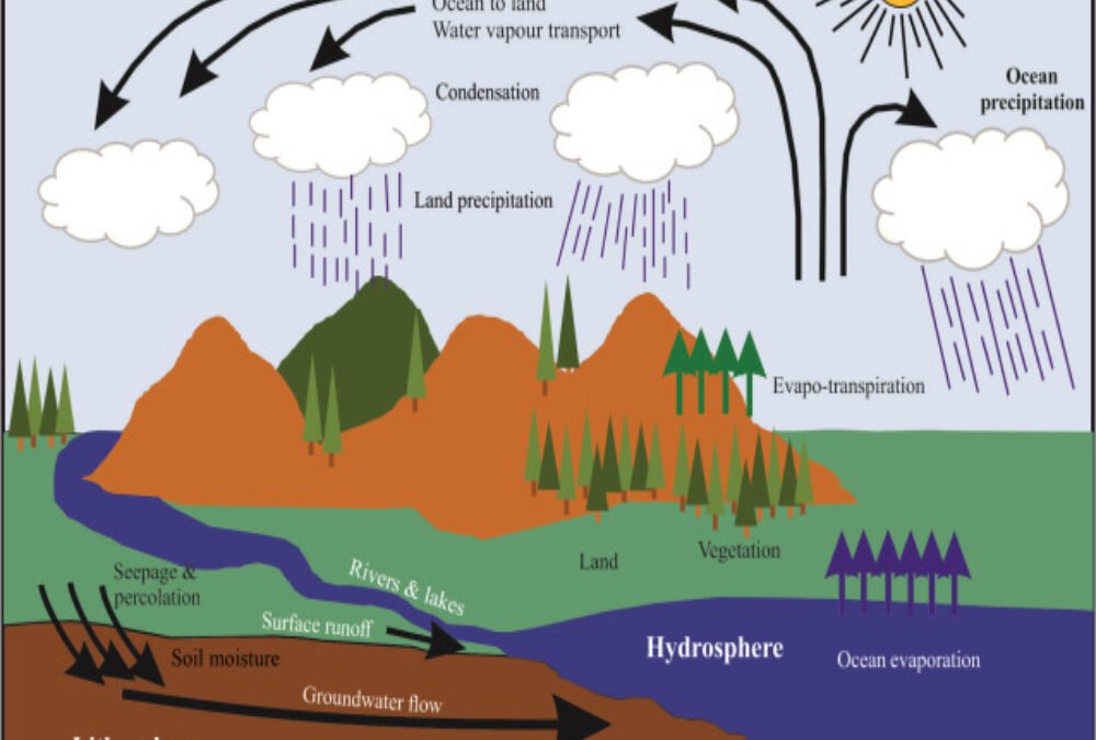
Hydrology, the study of water movement and distribution, plays a crucial role in the development of land, particularly in areas involving construction, urban planning, and environmental management. Hydrological features, including water bodies, groundwater, drainage patterns, rainfall distribution, and flood risks, directly affect the design, construction, and long-term viability of development projects. These features must be thoroughly understood and addressed to ensure sustainable, safe, and efficient land use. Proper hydrological planning ensures that water resources are managed effectively, minimizing flood risks, optimizing water supply, and preserving local ecosystems. This article explores the key hydrology features that influence development projects and highlights their importance in shaping decisions related to land use, construction, and infrastructure.
1. Surface Water Bodies (Rivers, Lakes, and Streams)
Surface water bodies, such as rivers, lakes, and streams, are fundamental hydrological features that can significantly impact development. Their proximity to a site often influences site selection, with developers needing to consider the potential for flooding, water quality, and the long-term stability of adjacent land. The floodplain, which is the area surrounding a water body, must be identified and protected to prevent property damage during high water events. Developers should also assess whether the site could benefit from the water source, such as for recreational purposes, irrigation, or aesthetic value, while minimizing potential negative impacts like erosion or water contamination.
2. Groundwater Levels and Aquifers
Groundwater, the water stored beneath the earth’s surface in aquifers, is an important consideration in land development. The depth of groundwater and the location of aquifers affect foundation design, water supply, and drainage. In areas where groundwater is close to the surface, developers must account for potential water intrusion into basements or foundations. Additionally, extracting groundwater for use in the development can have environmental consequences, such as over-extraction leading to depletion of local water resources. Proper management of groundwater is essential to ensure the development does not negatively impact local water supplies or the surrounding environment.
3. Drainage Patterns and Watershed Management
The natural drainage patterns of a site determine how water flows across the land, especially during rainfall. Understanding the watershed, or the area of land where all the water drains into a particular water body, is essential for managing runoff and preventing erosion. Poor drainage can lead to water pooling, localized flooding, and damage to infrastructure. Developers must design drainage systems that accommodate the natural flow of water, directing excess runoff away from buildings and other structures. This may include the creation of stormwater detention basins, swales, or permeable surfaces to reduce runoff and manage stormwater effectively.
4. Floodplains and Flood Risk
Floodplains, the low-lying areas adjacent to water bodies, are prone to periodic flooding, especially during heavy rain or snowmelt. When selecting a site for development, it is crucial to assess the risk of flooding and to consider whether the land is located in a designated floodplain. Building in flood-prone areas can increase the risk of damage to structures, disrupt the surrounding environment, and pose safety hazards to residents or employees. Flood risk assessments, including evaluating the 100-year and 500-year flood zones, are essential to determine whether flood mitigation measures such as levees, flood walls, or raised foundations are required.
5. Rainfall Patterns and Stormwater Management
The local climate and rainfall patterns significantly impact hydrological features and affect the design and infrastructure of a development. Areas with high annual rainfall or intense storms require robust stormwater management systems to prevent flooding and waterlogging. Developers need to understand local rainfall intensity, frequency, and duration to design effective systems for collecting, storing, and releasing stormwater. Techniques such as rainwater harvesting, green roofs, and permeable pavements can help manage stormwater, reduce runoff, and support sustainable development.
6. Erosion Potential
Erosion, the process of soil displacement caused by water movement, is a significant consideration in land development. Sites with steep slopes, fast-moving streams, or frequent rainfall may experience higher levels of erosion. Erosion can undermine building foundations, destroy landscaping, and degrade water quality in nearby rivers and streams. Developers must assess the erosion potential of a site and implement erosion control measures such as planting vegetation, installing silt fences, or using erosion-resistant materials to stabilize the soil.
7. Wetlands and Riparian Zones
Wetlands and riparian zones, areas adjacent to water bodies, are ecologically sensitive areas that provide essential environmental functions, including water filtration, habitat for wildlife, and flood mitigation. Development in or near wetlands and riparian zones is often regulated due to their ecological importance. Developers must conduct environmental impact assessments to evaluate how the development will affect these sensitive areas. Depending on local regulations, the development may need to incorporate buffer zones, restrict certain activities, or provide mitigation measures to protect these valuable ecosystems.
8. Runoff and Stormwater Discharge
Stormwater runoff occurs when rainfall exceeds the ground’s ability to absorb water, leading to surface runoff that can cause flooding, erosion, and pollution. Developers must evaluate how much runoff a site will generate and design systems to manage stormwater effectively. This may include the installation of retention ponds, infiltration trenches, or vegetated swales to capture and slow down runoff. Proper stormwater management is vital for preventing water pollution and reducing the environmental impact of development projects.
9. Soil Permeability and Infiltration Rates
The permeability of the soil affects how quickly water can be absorbed into the ground. Areas with high soil permeability, such as sandy soils, allow water to infiltrate quickly, while low-permeability soils, such as clay, may result in water runoff and poor drainage. Developers need to assess the soil’s infiltration capacity to design appropriate drainage systems and to ensure that the site can handle stormwater effectively. In some cases, soil amendment or the use of drainage systems may be required to improve water infiltration rates.
10. Environmental Regulations and Permitting
Hydrological features are subject to environmental regulations and permitting processes, which vary by location. These regulations aim to protect water resources, prevent pollution, and ensure sustainable land use practices. Developers must be aware of local, state, and federal regulations related to water use, floodplain management, and wetland preservation. Obtaining the necessary permits and conducting environmental impact assessments are vital steps to ensure compliance and prevent delays in development.
Conclusion
Hydrological features play a significant role in shaping the feasibility, design, and environmental impact of a development project. Understanding and assessing these features—such as water bodies, groundwater, drainage patterns, flood risks, and stormwater management—are critical for ensuring sustainable, resilient, and cost-effective development. By incorporating hydrological considerations into site planning and design, developers can mitigate risks associated with water-related issues, optimize resource management, and create safer, more efficient buildings. Proper attention to hydrological features is not only essential for regulatory compliance but also for contributing to the long-term success and sustainability of development projects.